Monday, January 2, 2017

The Year in Pictures

Paddling Zen


I'd almost forgotten about this annual posting until I was reminded by a few other photographer friends who also do a "year in review" of sorts.  Usually I start this before the 1st of the new year, but a day or two late is okay.  Besides, it is kinda interesting to look back at the past 12 months to see where my camera and I had been.  Fun to follow the seasons and be surprised at unexpected things (a warm thaw, then blast of snow and back again) that I'd forgotten.  Reliving moments in time is not so bad either for knowing where we have been can set a compass stepping forward. (isn't that profound?). 
 This year in pictures may be a bit different that others-iphone images predominate...they say the best camera you can have is the one that's with you. So true.  I'm pretty happy with what can be captured by that tiny sensor, not always great, but better than missing a moment.  Many images were work related-when you're in the field as a wildlife technician, you get to be in a lot of beautiful places and at perfect times of day.  There will be a lot of paddling ones too-I'll apologize for that off the bat-kayaking has really been something I love and the camera is always there.
As in the past-the images that follow are not perfectly chronological, but close.  They are also not all A+ or even A grade images-some make the cut here just because.  Because I like them or the place or the time.  Hopefully, some are good images irregardless.  2016-enjoy.


Sweaty Yeti-Marty on Bear Den

Ice "Caves" of Wedges Creek


Sharp Shinned and Ex-Blue Jay


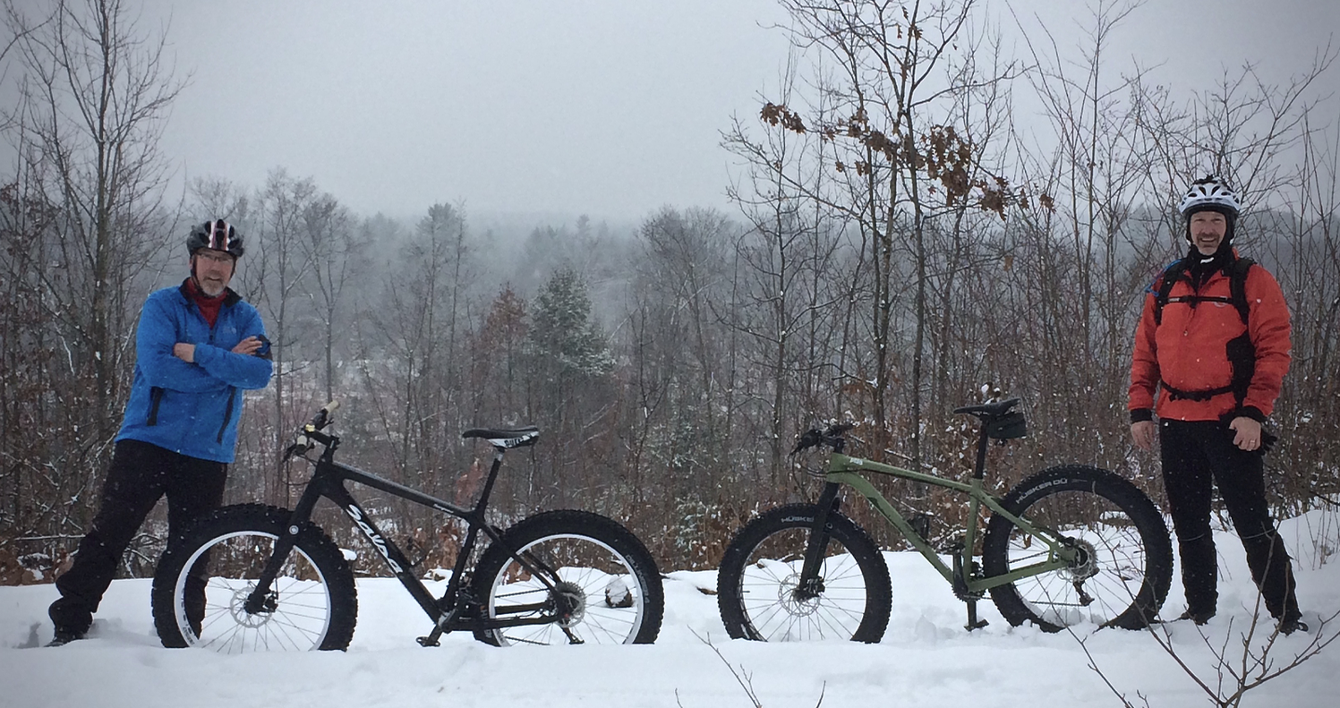
Dan's Berm-Fatbiking


BE in Popples


The River Folds Itself-Wedges Creek


Pewits Nest-Baraboo

I'd seen many stunning photographs of Pewits Nest over the years, and had driven nearby many times while heading to BAAP (The Ho-Chunk Nations Badger Army Ammunition Plant) for wildlife work.  Heading down in the dark one morning-I arrived at daybreak.  Chest waders would have been helpful, but I managed to crawl around and get a few images.  Although it's a beautiful place, too much "love" has eroded much of the natural shore and surrounding ground cover.  I found it surprising the state doesn't try to preserve this little sliver of land more.  I had it to myself this morning-much appreciated.


Miatke Farm at Daybreak


"That Tree"
I'd been just down the road from "That Tree" twice while at the Hirsch Farm for Gnomefest, but missed the chance to stop.  Last spring, traveling nearby, the truck veered off 151 and detoured south for a chance to see my friend Mark Hirsch's baby.  He does such great work and it had to be seen in person to really appreciate his project-taking an iphone image every day for a year (and it continues!)  This old girl was awe inspiring.


Simek's Pond


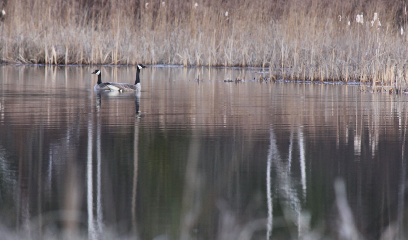
The Goose and Gander


Ravens and Bald Eagles-Dinner Time, Levis Mound


Meadow Lark-Buena Vista Grassland


Life, Death, Colour


Halls Creek Thaw- Dan Hiller


BE-Looking for Lunch


Spring Run-Kenosha (How does that horizon work?)


Levis Mound Chalet Fire


Red Cliff Reservation-Lake Superior
Not one of my photographs, but rather from good friend Mark Haferman, one of my kayak mentors.  I just had to include it here because of the great and frustrating memories of this anticipated trip to the Apostle Islands.  This was one of the great ones.


Mark and the Arctic Hawk- Red Cliff, Apostle Islands


Fairyland-Robinsons Creek


Big Blue Stem-Sturtz Prairie


Lake Eau Claire Shadow Moves


Lake Arbutus Revealed


Northfield Morning


The Mondeaux


Nosing Chequamegon Waters


Autumn Morning tugging at the Lake


Telemarken Road Aspen


Elk in My Woods


Merlin-Jeanne Reed's Farm

Not an exceptional photo, but to see a Merlin, for me anyway, is so rare that I had to include it.  He/she sat motionless while the truck crept closer and closer and luckily, I had the big zoom and camera along to get some images.


LaValle Wisconsin-Oak in Arms


Prepping for Winter-Beaver Pond, Columbia

Friday, October 7, 2016

The Otter


Paddling had never seemed so effortless, so smooth, the boat slicing through the water silently. I didn't notice the paddle stroke, just rhythmic and unconscious. All attention was drawn to the color the kayak was sliding by. It may be cliché, but I was in peaceful awe of the spectrum of hues encircling this lake. There was no need to rush, to get from one end of this body of water to the other, or maintain a steady pace. Somehow, I found myself exploring back bays and islands and shorelines I'd never ventured to with seemingly no exertion. “Zen” is overused perhaps but maybe I had accidentally slipped into it.

The long irregular blue shape on Google maps drew my attention last year-it was roughly halfway between Interstate 29 and state hiway 64 near Stanley Wisconsin-Otter Lake. This flowage is formed by Otter Creek, which eventually flows north and west into the Yellow River in Chippewa County. I'd ventured there just twice, both summer paddling trips and each time thought it must be an amazing place in the fall. Surrounding thick forest is mostly comprised of sugar maple-the most brilliant of autumn trees. This had the potential to be a magical place when the calendar flips to October.

I'm getting this sense of urgency-that winter is around the corner- kinda absurd, September is just a few days behind. I've been here before-somehow October comes and goes too quickly-perhaps because it's my favorite month and I have to be outside every minute. I'm resolved to get as much outdoor time in as possible, and the paddling days will be numbered-a trip to Otter was on the list.

The lake is long and narrow-4 miles from end to end, with little back bay nooks and crannies. It's a fishing hotspot and there always are a few boats plying their luck. The northern half of the lake is mostly public and free of cottages and homes. Otter Lake county park campground and day use area are located here along with several boat landings. I'd put in at an unimproved one before and it worked well for my 17 foot sea kayak.

With few man made structures to spoil the scenery, I paddled and explored this far end of the lake. Each corner I rounded revealed a more luminous view-that cannot be understated. As a photographer, It was frustratingly hard not to shoot a million images, but after a while, I gave up-the camera just needed to be put away. Images would have to be just captured in my minds eye-sometimes that's okay too.

That's when the instinctual paddling began-the kayak just gliding from place to place evidently by itself-attempting the impossible task of taking it all in. I was aware of this and consciously appreciating it. I don't know if one can pin down the exact date when colors peak at any one place, but I'm pretty sure on this day I did. I can't image it much better and from a boat, 3 “ above the waterline, I had the perfect vantage point to experience it.


Thursday, August 4, 2016

The "Mondo"

The bird slid motionless through unseen layers of air high above the hemlocks, spruce and birch-it had taken an hour and a half to appear. “Finally,” I thought to myself- I never tire of witnessing eagles. I'd expected to at some point, for this was the perfect habitat, but he or she, wan't on my schedule. Subconsciously, I put a check next to box marked “Bald Eagle, adult.” Already crossed off were Great Blue Heron, Common Merganser, Kingfisher, and mallard. I wasn't out on a bird watching excursion, so there were other things on the imaginary list as well-towering red and white pine, clear water, and “Canadian-esque” surroundings. This is as close to our neighbor to the north as you'll find in central Wisconsin.

The Mondeaux Dam Recreation Area, located outside of Westboro in Taylor County, is a gem within the Chequamegon National Forest. In 1933, the forest service began acquiring land here and in that same year, Camp Mondeaux River was established, (a depression era CCC camp). The young men stationed at the camp would play an important role in the development of “Mondo.” Their primary role was to develop the facilities within the new National Forest-building trails, bridges, tree planting and also suppressing fire. Archie Campbell, a local mechanic at the camp, suggested damming the Mondeaux River to provide recreational opportunities. Work began in 1936-37 and was ready to be flooded in 1938. The Mondeaux Flowage was born.

I'd visited a campground here many years ago and even had a chance to hike a lightly used portion of the ice age trail which passes through the Mondeaux area. The lake created by damming the north flowing river is almost four miles long and varies from a few hundred yards to a quarter mile wide-remnants of a glacial “tunnel channel” and “esker.” Remembering that I'd paddled a canoe here long ago, I thought it'd be a perfect place to kayak when looking for “new” water to explore.

Reconnaissance of new lakes or rivers for kayaking sometimes takes the form of just scrolling and zooming on Google maps. A large irregular blue shape requires closer scrutiny. Have I been there before, how far is it? Is it worth the drive to consider investigating? That's as simple as these things start-and it can pay off.

The locals call it “Mondo” Dam, I prefer the French. It's fairly popular on weekends, with mostly a few fishermen plying their luck along the thick forest shorelines or scattered rice beds. On weekdays, I'd expect to have the quiet waters mostly to yourself.

After a 90 minute drive, paddling friend Mark and I put in at a steep overgrown old canoe launch on the far south end-basically the start of the “lake.” There is parking for one vehicle next to the wood bridge on forest road 102. We did our best to clear out brush to reach the tiny narrow bank and without too much adversity, had both boats in the lily pad topped stream.

Paddling northward through a narrow channel of open water, the lake gradually widens. The only private cottages are located here on the south west side, with the east and far end all undeveloped national forest. As the kayaks continued, we were surrounded by more and more of that “up-North” feel, yes very much like Canada as I mentioned. Perhaps it's the size of the pine and Hemlock, the quietness, or the feeling of being in a remote place. That sense only occasionally disturbed by small fishing boats passing by. Several modest and simple campgrounds peek out here and there from the dense forest, but we see few people.

Mondeaux is all flat water paddling and it's not always clear which channel was the main one-no matter, we'd explore any and all of them if needed. Mark and I both eyed up remote campsite locations on the small islands we passed-this would make a great fall return trip. We'd take a cue from the fishermen as they'd pass as to where to continue and eventually made it to the Mondeaux Dam Lodge, which is listed on the National Register of Historic Places. The building remains in a rustic style, much as it was when built in the 1930's. There is a small store here and canoe and kayak rental with a beach and picnic area. The original cement dam is sited between two day use areas.

On the return trip, we did take some of the alternate waterways around islands and explored a bit more while cruising along the opposite shore. The eagle made its appearance, soaring above and kept us company for a while, a welcome companion. We continued on, returning to the cabins on the south end. A recent storm had a few residents revving chainsaws to clear downed trees high above on the steep shore. A few more paddle strokes under the bridge and we were constricted into the narrows of the Mondeaux “river”/creek/stream/backwaters-a weedy thread where we began our outing two hours earlier.

From a suggestion to the CCC supervisor in April of 1935 by land owner Archie Campbell, to what is now considered to be nonpareil within the Chequamegon National Forest, the “Mondo” was all we'd hoped for in a “new” water discovery. My brief canoe stint 25 years ago didn't reveal just how inviting this lake could be from one end to the other for the paddler. Another box could be checked on my make believe list- Paddling water, scenery, superb.


Tuesday, August 2, 2016

The misi-ziibi


The Mississippi, the Ganges and the Nile,...the Rocky Mountains, the Himmaleh, and the Mountains of the Moon, have a personal importance in the annals of the world.: - Henry David Thoreau

The current is deciding. You see it, you see the effects it has, you know it's there. The bow of my boat just nudges the ripple of water deflecting of the leading edge of the island. Before the next paddle stroke, the kayak pivots in the current, turned broadside to the rivers breath, and I'm off course.

It isn't far across the main channel of the Mississippi in downtown LaCrosse, but the strength of the flow has a purchase on my boat, forcing it to ill-favored directions. The kayak paddle dips deeper and is pulled back with more force-I inch closer to the park on the west shore.

The bow came about at the last second and slid up onto the sand at a small beach. From the bank where I now rested, I could see across to the hustle and bustle at Riverside park, the traffic downtown and the steel bridges spanning the river. I lifted the boat from the water and set about stowing gear, my foray down the 'ol Miss was over.

***

Pool 6 and the lock and dam at Trempeleau was my put in. I'd wanted to avoid having to pass through any locks, not really knowing how that experience would go in a tiny craft. Better to stick with what I'm familiar with. I'd mapped out a reasonable day trip from here to LaCrosse, about 15 river miles, with one portage at French Island to avoid locking through at Dresbach Minnesota. My enthusiasm for kayaking has grown, so it was just a matter of time before I'd have to paddle the “misi-ziibi,” the Ojibwa name for the river.

Thoreau recognized the importance of this waterway. It influences everything within its reach. For me, “the gathering of waters” (another nickname) always takes me back in time-connects me to the history of this river valley. She has always dominated here. As a paddler, riding the current would give me a kinship with all others who have ever navigated her.

My close friend Kirk and his wife Lynn, met me at the flooded landing-they were kind enough to shuttle my truck to LaCrosse after I launched. It was very early morning and I appreciated their help. Kirk's parents live a few miles downstream on the Minnesota side so there was a chance I'd see them during their morning coffee excursion (I did, one of the few boats on my entire trip). The kevlar boat had her nose in the water and was outfitted for the trip as we said our “hi's” and “good byes” and I pushed out from shore.

Just how strong the river is became immediately apparent-the boat, instead of setting off downstream, was sucked up into the dock by the eddy behind the lock. A bit un-nerving to start, but going into this adventure I knew to respect every aspect of the “old Man River.” A few strong pulls prodded the boat out away from the lock and dam and breathing swells of the water pulled me downstream. I'm off.

I'm a rookie at Mississippi paddling-this was my first time and knowing her power, I'd decided to stay closer to the shore than away. The main channel, though not deep, holds all of the vigor of the river and until I had my “sea legs,” I 'd be better off in the margins-not that one can let their guard down there either.

Wing dams were first constructed in the 1800s to aid in deflecting current into the shipping course-there are thousands of these rock piles extending out from shore. Luckily, they are easy to spot by looking for ripples and waves sprouting up diagonally from the riverbanks. For a kayak, they aren't a big problem-there is no danger of hitting them like other boats may have-still, they produce swirls and funky whirls and in an instant, the you're off course. They are built at fairly regular intervals, so you'd just expect them as a continuous feature while paddling. The strangest phenomenon they produced was a standing wave of sorts from a passing sand barge. The tug was far to the opposite side, but when it's wake finally rolled onto the wing dam, it created a strange wide multiple wave crest of water. At first I hadn't a clue what it was-just that it was concerning as it approached. It did make sense, just as a wave builds up as it hits a shallow beach, the same was happening here, and luckily, was easy to slice through.

With the river pushing me along at a decent clip, I made good time. I hugged the Minnesota side, where the current was greatest, and was trusting my ability to use it to my advantage. Run down old boat houses showing signs of repeated flooding, contrasted with multi million dollar modern river homes higher up overlooking the water. It seemed to be a losing battle to challenge the river here-build too close to her and she'd reclaim her shore sooner or later. Old foundations, rip rap and precarious leaning piers lined the banks here and there near old rail road sidings higher up.

The Wisconsin side of the river is characterized by backwaters, side channels and sloughs worthy of exploring as well. At Dakota (MN) I crossed eastward into the “braided stream zone” of upper Lake Onalaska. It's a maze of small islands and floodplain forest, critical habitat for waterfowl and other aquatic life. Fish seemed to be abundant here, rising to the surface in a startled boil or jumping at newly hatched mayflies. Surprisingly, I met few boats, anglers or otherwise.

At Dresbach, the lock for pool 7 lies on the west shore. A long mile and a half long earthen dam extends east to French Island, capping off the south end of Lake Onalaska. Two adjacent boat landings span the dike and made it possible to portage over to what is known as the French Lake (the Black River is on the east side of the island and its delta lies 9 miles north, above Brice Prairie). Water was very high and the boat launch dock sat alone out in the slough-useless for anyone to use. I slid back in and headed south toward Lacrosse. French Lake here really is just a narrow channel along French Island with off-shoot waterways that eventually connect back up to the Mississippi. Except for a couple fishermen, I had these river bottoms to myself.

Strangely, after a fair amount of calm water paddling, I hit current from the west-a good indicator that I was nearing the big river again. The narrow artery (Smith Slough) crossed south of “Round Lake” (another backwater) from the Mississippi pushing my kayak to the south tip of the island. Here, industrial facilities started to appear, evidence I was nearing La Crosse and the end of my trip.

A few more boats appeared, in or back out from the marinas on the Black. It was strange to just be plopped out into the main channel directly at downtown La Crosse near Riverside Park. The strength of the water grew here and down river I could see a massive barge beating its way north toward the twin cities-I wondered what that trip must be like. My best bet would be to duck into the lee side of a mid-channel island and use the eddy near shore to push me upstream. At the head of the island I'd need to cut across the river's flow to make it to Pettybone Park, my pick up point.

With the Mississippi running at maybe four miles per hour, I'd made good time-even with plenty of flat water. It seemed I'd barely lifted the kayak onto the truck and my mind already raced onto where “Ol' Man River” would take me next-this half day trip just whet the adventure appetite. Thoreau knew the greatness chronicled in these flowing waters and now I could add it to my journal and history as well.


Monday, July 25, 2016

The Lake is the Boss

The lake is the boss. It's pretty simple really. She doesn't care what your plans are, doesn't matter if your bucket list isn't filled, concerned little with how much you've prepared. The lake, mother nature, is the custodian of all that happens here. The cold waters, and her islands worry little of forecasts and plans.

The boss is Lake Superior within the Apostle Islands. This statute would apply anywhere on Gitchigumi, but in particular within this National Lakeshore in the northern most realm of Wisconsin. Under the protection of the US National Park Service, the lakeshore is comprised of 21 islands and shoreline, totaling 70,000 acres. Located in the coldest of the great lakes, it's know for sandstone sea caves, historic lighthouses, natural wildlife habitat and traces of old growth forest.

The Apostles are one of the places most kayakers would have scrawled on a napkin, perhaps with a crude map outlining island hopping and a list of the best campsites next to a penciled in calendar. Those scraps of paper devising the trip may sit idol for years, but they are always there, waiting.

In reality, I didn't have any notes or maps tucked amonst my outdoor gear in the basement, but that drop in my pail was there and the adventure would happen at some point.

Sea kayaking was introduced to me a little over a year ago when I joined some friends in a borrowed boat for a paddle on Lake Arbutus in central Wisconsin. I have a canoe background, but had never really spent any time wetting a double blade from a kayak. The sport appealed to me-there is an quiet escape as the prow slices silently through the water. I tried a couple different boats that day and realized I may as well start checking Craig's List-I'd have my own soon. A week later, a 17 foot Current Designs Caribou had found a home in my garage.

I'd listened to stories of paddling, particularly Apostle Island paddling, from friends Mark and Tom for years. Adventure tales, yarns and sometimes, scary stories. They are both experienced big water paddlers, and in taking me under their wing, learned to be very patient. Slipping a tippy long boat into the water and making it go where you want it safely, does have a learning curve. The design of these particular “Greenland” boats are characterized by feeling tippy but having good secondary stability-great for skilled paddlers, less so for a novice. In any regard, they are fast and efficient, and well suited for tripping-I'd need practice.

With a year of paddling under my belt and another 'yak in the garage (a whitewater model for frigid spring runs), the urge to finally make the Apostles happen was set in motion. With campsite reservations made, the “training” proceeded. Mark and I ventured out a few times on local flowages and the Mississippi and I made a habit of a early morning launches into Arbutus a few times a week to improve my technique and strength. Confidence and anticipation were growing.

Our best laid plan was to head to Little Sand Bay (park headquarters) via Ashland and Bayfield and do a half day paddle to York Island, or first stop. So much for an agenda-the lake didn't care.

The late Monday night storm to hit northern Wisconsin changed all that. Our Tuesday morning drive halted in Mellen - hwy 13 was gone just north of there. A canyon replaced where the road had once been. No fix there soon. We tried some town roads instead and none were passible. Amazing. Checking with a local, it appeared the only way to Ashland was to backtrack and head west to state hi-way 53, a 3 or 4 hour detour!

Eventually, after a few more deversions and a flat tire, we made it to Chequamegon Bay outside of Ashland and Washburn, only to be greeted by a red plume of silt pumping out from Fish Creek and other small tributaries. Hope of saving our day one plans faded as we pulled into Little Sand Bay being pounded by strong winds, high waves and floating brick stained debris. The ranger reported numerous kayakers had to be rescued the previous evening there. On to plan B.

Late night rain pelted the small tent rainfly-”Well, this doesn't sound good,” I thought. Worse, winds buffeted the trees surrounding our campsite just outside of Bayfield, foreshadowing another day of delays.

Thinking maybe we could make a run at the sea caves outside of Meyers Beach, we took a spin to Cornucopia to check conditions, hoping for a favorable wind direction, as predicted. Nope, Rangers had the kayak launch and beach closed- “Small Craft Warning” said the sign on the barricade. Mother Nature is Boss. Descending to the beach, it was obvious why the lake was shut down-whitecaps crested 3 foot crimsom colored waves-water that had an unrestricted run all the way from Two Harbors Minnesota. No paddling here today.

Trying to salvage a day, we decided to get back to Bayfield and paddle the Friendly Valley beach area off the Sioux River which was protected. Any time on the cold (usually clear) water is a good thing, so a few hours in the swells was perfect to test out gear-wet suits and assorted paddling necessities. Glad I did-my PFD was constricting me and I felt terrible. The extra layers for cold water paddling required some adjustments and eventually everything was dialed in. Wet suits? Oh yeah, the lake demands respect and anyone in the water without one won't last long.

Reservations had us on Oak Island on Day 3, so with calmer conditions in the morning we decide to make an attempt to reach it from park headquarters again. Unfortunately, Little Sand Bay still had waves running high and from the west. No go. So much for the weather predictions again. Mark came up with an viable option however- maybe we could make it from the Bayfield side on the south-hopefully we'd be be protected from the wind in that direction.

A block off downtown Bayfield, we finally unloaded camping and paddling gear for our first island pursuit. As if to welcome us to this continuing adventure, the islands and the lake dropped a thick drippy fog bank on us as we made our first paddle strokes into the water. No matter, we're doing this.

Staying close to the lee shore, the paddle up to Red Cliff was pretty good-within a half hour I had my “sea legs” -that auto pilot feeling where balance and paddling are unconscious. Crossing some quartering wind at Buffalo Bay we were rewarded with beautiful brownstone rock faces which the lake continually carves and gnaws away. At 9 miles, we'd made good time, but it also couldn't be denied that the swell, waves and chop were growing. Mark mentioned that sometimes the Islands will force the wind to wrap around and change direction and that seemed to be ahead of us in the one mile crossing to Oak Island.

Being a good tutor, he kept checking- “How are you doing?” as the boats cut into some of the bigger water I'd ever been in. “Okay” which I mostly meant. With just a ½ mile to go and near the mid channel shipping buoy, the waves were breaking more and more-the lake resolved we needed to turn around-it wasn't worth the risk. She is the boss.

There was no thought to turning tail, it just is what it is. We beat it back to the Red Cliff Bay side and resigning ourselves to the long return trip. Along the way, paused to check out the shipwrecks of the Ottawa, Rambler and Coffinberry, all laid to rest in the late 1800s in a small shallow bay.

Maybe it was a wind shift, or just the lake and islands granting a repreve, but continuing down shore, the gentler swells and calming chop allowed us to make a few brief explorations of the small Red Cliff sea caves. They are remarkable and rugged and provided some photo ops and a break from churning out mile after mile in the boats.

Continuing south, and finally settling into a a good rhythm, I was suddenly about jolted from the cockpit as my boat seemingly barely missed colliding with a enormous structure directly below! As my heart returned to my chest, I realized it was a large shipwreck (the Fedora, lost in 1901) just below the surface. Spinning about, Mark and I followed the wood and iron skeleton along it's length (over 280 feet!) in what was a surreal sight this far off shore. Totally unexpected, but a highlight none the less. The lake does claim it's victims it seems.

Mark joked all week about options-we needed a lot each day of this trip. It seemed that as we paddled back toward Bayfield, Basswood Island, just across the north channel from us, was, well, right there. The gears were turning in my mentors head, and day three's “option B” would be to cross to Basswood-surely no one would be out at those campsites he suggested (we'd only seen one kayaker all week). Well, okay...lets try.

Just as in cycling the wind always seems to be in your face, in paddling, it's a quartering breeze that becomes your nemesis, always turning the boat making things difficult. We worked hard to cross and it was a relief to round the southern tip into calm sheltered water. Marks prediction was correct-no one on any of the 3 campsites here, a gorgeous spot above a small rock face.

As challenging as the rocky take out was, we managed to land and quickly set up camp. Black flies were tolerable and mosquitos kept at bay by the campfire. So camping here wasn't according to plan, but as it worked out, we had a beautiful view of Madeline Island and the city lights of Bayfield 3 miles distant. From our vantage, we'd watch a tour boat cruise by, a few sailboats and the ferries shuttling back and forth to La Pointe.

Our final day in the islands started with a discussion over camp coffee as to what “options” we'd have. No rush, rain the previous night soaked tents and tarps, so we'd need some drying time anyway. We'd toss in a quick hike to one of the 1800's brown stone quarries as well on Basswood-a little insight as to the difficult life people had here a hundred plus years ago (there also is an old farmstead located on the island). Although we looked at circumnavigating Basswood and then heading for port, the milage seemed a bit tall after the long paddles the previous day. Option C or D (I can't recall which) was to head across the east channel to Madeline, then down to La Pointe and finally cross to Bayfield. Seemed doable. But then again, the lake calls the shots.

Stowing gear in the boats and successfully launching off the bouldery landing, we settled into a cruise up the east side, passing by the old quarry dock, barely visible below the icy waters off shore. Sailboats began leaving the harbor, a sign that maybe we'd hit more wind than predicted again. What's good for sailing, isn't necessarily good for paddling. Mark coached to take a east heading, which would put us about halfway up Madeline's west shore. Easier said than done.

If I learned anything from this crossing, it's to trust your boat. The waves rolled in at about two feet, not huge, but about as large as I wanted. Greenland kayaks are designed for this-the Inuits have thousands of years of R & D of both the boats and paddles-they used what worked. As long as I steadfastly watched the next wave quartering in, and had good paddle placement, the boat would roll up and over like it's designed to. As Mark once observed, these are the most sea worthy water craft out here. I hoped so.

The crossing was taxing because we had to paddle on one side 90% of the time-neither of us had skegged boats. Even after reaching shore, the winds ran down along the lakeside and in places, the waves and swells were larger hitting the shallow water. One or two small bays offered rest, but at some point, we both realized we were not paddling to Bayfield-trying to cross the channel again, even further, was not going to happen this day-the lake had determined as much.

Not thinking Superiors water could get more raw, I was wrong-rounding the tip of Madeline, suddenly both of us realized our hands starting to freeze. It seems the boat and ferry traffic here churns and mixes even colder water from below if that's possible. Wallowing in the swells near the break wall, the boats turned and headed into the welcome sand of the beach-my arms and back appreciative of the rest.

Perhaps a bit out of place among the floppy hat, white short, Hawaiian shirt tourists here, we marched up a side street in wet suits to change into “civilian clothes-” a better option for downing a burger and beer at the lakeside bar and grill. A ticket on the Island Queen to reach Bayfield was just $14 with our kayaks. Deal. Seemed a simple resolution at this point, right? Well, the lake is the boss and it was as if she wanted to tease our plans one more time. Instead of big waves hindering our paddling, a consistent edict all week, she calmed the waters, forcing us to second guess our decision. With gear already stowed, we both looked out over the 4 mile crossing most likely thinking the same thing. Dismissing the thought (not easily), we both reached down instead and grabbed a handle on a kayak and started the haul to the ferry dock.

It's known by some the islands in the Apostles shape and mold the weather here to their liking. The 21 dots of land and the deep cold waters of Superior are in their own world and they govern the weather as they wish. Although not unfolding like we'd planned, spending time with boats, water and friends in the Apostles is always rewarding. No matter the long range forecast, or your reservations, the lake is the boss.


Wednesday, May 25, 2016

The Coho Alarm

The alarm didn't stand a chance of going off-through blurry eyes, I reached over and canceled it before the annoying buzzer could jolt me from bed. I'd been staring at the barely focused digital numbers for 20 minutes and I may as well roll out-there wouldn't be any more sleep. Besides, getting on the road earlier (by 2:15 a.m.) would put me downstate that much sooner-4 hours in the truck, Neillsville to Kenosha, was long enough. The sun would be up at the harbor for a good hour by the time I set foot on the boat.

Coho salmon, one of my favorite fish, are not early risers anyway, or should I say early biters unlike their big Chinook brothers. No need to slip out of the marina in predawn darkness. Many of the charter captains in south east Wisconsin enjoy this little extra zzzz time as well in the spring. A more leisurely start allowed me to make the cross state drive and still get a full day of fishing in-”banker hours fishing” captain Kris would say.

The Corkscrew, owned by good friend Kris Davis, would be the vessel of choice to hunt down cohos, steelhead (rainbow trout), lakers or maybe even a king or brown-a mixed bag sometimes in late spring. Kris runs Northfork Sportfishing Charters and has quickly become one of the more respected captains departing the Simmons Island Marina in Kenosha Wisconsin.

I try to join Kris whenever I can on Lake Michigan, especially in the spring- cohos are arguably the best table fare to be pulled from the big lake in my opinion. The small silver fish, usually 3-5 pounds by their third year , seemed to be running bigger this year, which brought no complaints from us! They'd been aggressive for the past week or so and I had high expectations of bringing a few home for the grill. Steelhead would also be willing to hit, as Kris had put a good number of them in the cooler the previous day.

Usually, coho are somewhat predicable-they start biting in the southern waters near Indiana and Illinois and the season progresses northward following the warming temperature of the lake water. Find the preferred water temp and you'll find fish. That's the usual scenario. This year? Not so much.

I met Kris, his dad Ed and friend Wayne at the dock and quickly stowed gear, untied and no-waked out through the harbor-a clear and sunny day with just a little chop on the lake greeting us. A few lakeside fisherman were set up along the wall plying their luck in shallow water for browns, steelies and maybe a few cohos as we slowly motored past. Entering the wide expanse of “mishigami “ the boat quickened it's pace. The Corkscrew is powered by two 350 marine engines and there is a satisfying deep roar from them as they throttle up leaving the shore quickly behind. I love that part.

As Kris set a course for”the fence” (Wisconsin Illinois border 8 miles south) the boat seemed to be heading much further ofshore than our usual coho fishing grounds. Watching the fish locator screen, the bottom was dropping away-50', 100, 250+ deep. Curious, I asked Kris and it seemed the fish had no rhyme or reason this year for where they were hitting. Normally, there is a parade of hopeful boats patrolling up and down across “the bubbler” (Kenosha's warm water discharge) in 40-50 feet of water or the same near Racine's Root River estuary, but not 10 to 15 miles out! It seemed they were staging in very deep water and hitting lures anywhere from the surface to 100 feet down. Kris was hedging all bets, using planer boards, dipsey divers and down-riggers to test all depths and see what they preferred. The added bonus of such a range is other species like lake trout and king salmon could end up in the tub.

You go where the fish are and although this was unconventional coho fishing, the word was out and we had plenty of company. Kris kept the 350's churning and we set up closer to 300' of water, further out from the other boats. With four of us onboard, we'd put out a spread of six high planers, three mid level dipseys and three deep 'riggers to cover all bases. It didn't take long.

“Fish on!” ...and there was an excited hustle to grab a rod and net and boat the first fish of the day-a steelhead. Before it could be scooped up, another planer board was jerked backwards-”fish, FISH!, bottom pole!” and all four of us scrambled to somehow not get tangled up, yet land the trout. We did, and the steelies were stowed on ice and poles re-deployed. “FISH!”-another bait is hit-this time on a deep line, pulling hard- most likely not a rainbow. This is how to start a trip and as Wayne brought the fish in close, we could see it was a nice lake trout.

As quickly as it all started, there was a lull, but that's fishing. This scene would repeat itself all day, we'd hit one or doubles or even three in a row in a spot and then they would shut down. Kris would swing by the same spot and sometimes another salmon would be added to our catch, sometimes not. None of us minded all that much-it was a beautiful day on the lake, but then again, catching fish is better than not our captain would remind us-yeah, it is.

Eventually, most of the other boats cleared out, chatter on the radio indicated they were not having the same slow-but-steady luck as the Corkscrew was. If the fish wanted high placement, Kris would move some of the lures higher-if they were finicky about color or pattern (even if it was a guess), spoons and flies would be swapped out to maybe antagonize a few more hits.

Afternoon fishing hadn't been all that good of late, but we continued on. Finally, after a threat of “we'll give it 15 more minutes,” things restarted-so much so, that we counted and re-counted the number of fish in the tank to be on the good side of a limit. It was a final flurry of action ending with a near triple like we started the day-perfect.

All of us had long drives back home after a day on the water, so Kris turned the boat north west and we let some lines drag while pulling one set of gear after another-you never know about last chance fish. After everything was stowed and tucked away, the boat roared forward for the 10 mile trip back to the “candlestick” (breakwall light) of the Kenosha harbor.

Most of the other charters were already nestled into their slips by the time we returned-the Corkscrew had stayed later, but it paid off with the extra fish on board. In short order, the Corkscrew too was buttoned up and ready for the next trip. The fish were divided and iced in coolers-mine would have to be cleaned later in the night. Already I had plans for cedar grilled and smoked salmon and trout-I couldn't wait. Although not a crazy fish-jumping-in-the-boat kind of day, it was great and all of us happy and appreciative with the action and bouts of fun frenzy when rods start bending back on themselves. My alarm is already set for the next trip.

Smith: Tracking surveys remain critical part of DNR's gray wolf population estimate in Wisconsin

  Smith: Tracking surveys remain critical part of DNR's gray wolf population estimate in Wisconsin Tracking surveys by DN...