Showing posts with label paddling. Show all posts

Monday, January 2, 2017

The Year in Pictures

Paddling Zen


I'd almost forgotten about this annual posting until I was reminded by a few other photographer friends who also do a "year in review" of sorts.  Usually I start this before the 1st of the new year, but a day or two late is okay.  Besides, it is kinda interesting to look back at the past 12 months to see where my camera and I had been.  Fun to follow the seasons and be surprised at unexpected things (a warm thaw, then blast of snow and back again) that I'd forgotten.  Reliving moments in time is not so bad either for knowing where we have been can set a compass stepping forward. (isn't that profound?). 
 This year in pictures may be a bit different that others-iphone images predominate...they say the best camera you can have is the one that's with you. So true.  I'm pretty happy with what can be captured by that tiny sensor, not always great, but better than missing a moment.  Many images were work related-when you're in the field as a wildlife technician, you get to be in a lot of beautiful places and at perfect times of day.  There will be a lot of paddling ones too-I'll apologize for that off the bat-kayaking has really been something I love and the camera is always there.
As in the past-the images that follow are not perfectly chronological, but close.  They are also not all A+ or even A grade images-some make the cut here just because.  Because I like them or the place or the time.  Hopefully, some are good images irregardless.  2016-enjoy.


Sweaty Yeti-Marty on Bear Den

Ice "Caves" of Wedges Creek


Sharp Shinned and Ex-Blue Jay


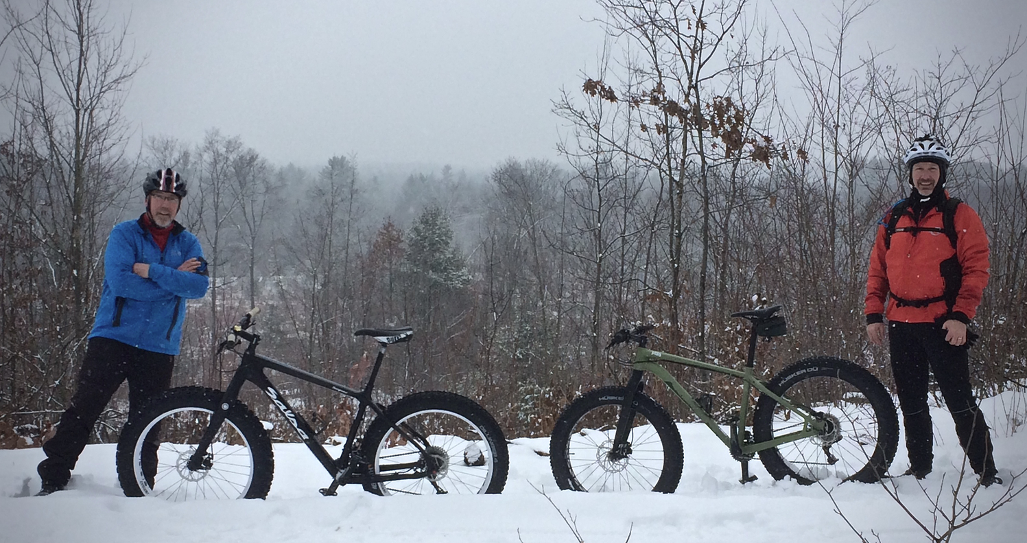
Dan's Berm-Fatbiking


BE in Popples


The River Folds Itself-Wedges Creek


Pewits Nest-Baraboo

I'd seen many stunning photographs of Pewits Nest over the years, and had driven nearby many times while heading to BAAP (The Ho-Chunk Nations Badger Army Ammunition Plant) for wildlife work.  Heading down in the dark one morning-I arrived at daybreak.  Chest waders would have been helpful, but I managed to crawl around and get a few images.  Although it's a beautiful place, too much "love" has eroded much of the natural shore and surrounding ground cover.  I found it surprising the state doesn't try to preserve this little sliver of land more.  I had it to myself this morning-much appreciated.


Miatke Farm at Daybreak


"That Tree"
I'd been just down the road from "That Tree" twice while at the Hirsch Farm for Gnomefest, but missed the chance to stop.  Last spring, traveling nearby, the truck veered off 151 and detoured south for a chance to see my friend Mark Hirsch's baby.  He does such great work and it had to be seen in person to really appreciate his project-taking an iphone image every day for a year (and it continues!)  This old girl was awe inspiring.


Simek's Pond


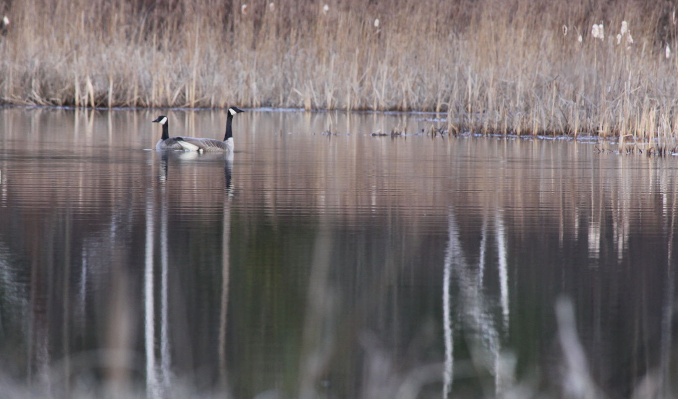
The Goose and Gander


Ravens and Bald Eagles-Dinner Time, Levis Mound


Meadow Lark-Buena Vista Grassland


Life, Death, Colour


Halls Creek Thaw- Dan Hiller


BE-Looking for Lunch


Spring Run-Kenosha (How does that horizon work?)


Levis Mound Chalet Fire


Red Cliff Reservation-Lake Superior
Not one of my photographs, but rather from good friend Mark Haferman, one of my kayak mentors.  I just had to include it here because of the great and frustrating memories of this anticipated trip to the Apostle Islands.  This was one of the great ones.


Mark and the Arctic Hawk- Red Cliff, Apostle Islands


Fairyland-Robinsons Creek


Big Blue Stem-Sturtz Prairie


Lake Eau Claire Shadow Moves


Lake Arbutus Revealed


Northfield Morning


The Mondeaux


Nosing Chequamegon Waters


Autumn Morning tugging at the Lake


Telemarken Road Aspen


Elk in My Woods


Merlin-Jeanne Reed's Farm

Not an exceptional photo, but to see a Merlin, for me anyway, is so rare that I had to include it.  He/she sat motionless while the truck crept closer and closer and luckily, I had the big zoom and camera along to get some images.


LaValle Wisconsin-Oak in Arms


Prepping for Winter-Beaver Pond, Columbia

Friday, October 7, 2016

The Otter


Paddling had never seemed so effortless, so smooth, the boat slicing through the water silently. I didn't notice the paddle stroke, just rhythmic and unconscious. All attention was drawn to the color the kayak was sliding by. It may be cliché, but I was in peaceful awe of the spectrum of hues encircling this lake. There was no need to rush, to get from one end of this body of water to the other, or maintain a steady pace. Somehow, I found myself exploring back bays and islands and shorelines I'd never ventured to with seemingly no exertion. “Zen” is overused perhaps but maybe I had accidentally slipped into it.

The long irregular blue shape on Google maps drew my attention last year-it was roughly halfway between Interstate 29 and state hiway 64 near Stanley Wisconsin-Otter Lake. This flowage is formed by Otter Creek, which eventually flows north and west into the Yellow River in Chippewa County. I'd ventured there just twice, both summer paddling trips and each time thought it must be an amazing place in the fall. Surrounding thick forest is mostly comprised of sugar maple-the most brilliant of autumn trees. This had the potential to be a magical place when the calendar flips to October.

I'm getting this sense of urgency-that winter is around the corner- kinda absurd, September is just a few days behind. I've been here before-somehow October comes and goes too quickly-perhaps because it's my favorite month and I have to be outside every minute. I'm resolved to get as much outdoor time in as possible, and the paddling days will be numbered-a trip to Otter was on the list.

The lake is long and narrow-4 miles from end to end, with little back bay nooks and crannies. It's a fishing hotspot and there always are a few boats plying their luck. The northern half of the lake is mostly public and free of cottages and homes. Otter Lake county park campground and day use area are located here along with several boat landings. I'd put in at an unimproved one before and it worked well for my 17 foot sea kayak.

With few man made structures to spoil the scenery, I paddled and explored this far end of the lake. Each corner I rounded revealed a more luminous view-that cannot be understated. As a photographer, It was frustratingly hard not to shoot a million images, but after a while, I gave up-the camera just needed to be put away. Images would have to be just captured in my minds eye-sometimes that's okay too.

That's when the instinctual paddling began-the kayak just gliding from place to place evidently by itself-attempting the impossible task of taking it all in. I was aware of this and consciously appreciating it. I don't know if one can pin down the exact date when colors peak at any one place, but I'm pretty sure on this day I did. I can't image it much better and from a boat, 3 “ above the waterline, I had the perfect vantage point to experience it.


Thursday, August 4, 2016

The "Mondo"

The bird slid motionless through unseen layers of air high above the hemlocks, spruce and birch-it had taken an hour and a half to appear. “Finally,” I thought to myself- I never tire of witnessing eagles. I'd expected to at some point, for this was the perfect habitat, but he or she, wan't on my schedule. Subconsciously, I put a check next to box marked “Bald Eagle, adult.” Already crossed off were Great Blue Heron, Common Merganser, Kingfisher, and mallard. I wasn't out on a bird watching excursion, so there were other things on the imaginary list as well-towering red and white pine, clear water, and “Canadian-esque” surroundings. This is as close to our neighbor to the north as you'll find in central Wisconsin.

The Mondeaux Dam Recreation Area, located outside of Westboro in Taylor County, is a gem within the Chequamegon National Forest. In 1933, the forest service began acquiring land here and in that same year, Camp Mondeaux River was established, (a depression era CCC camp). The young men stationed at the camp would play an important role in the development of “Mondo.” Their primary role was to develop the facilities within the new National Forest-building trails, bridges, tree planting and also suppressing fire. Archie Campbell, a local mechanic at the camp, suggested damming the Mondeaux River to provide recreational opportunities. Work began in 1936-37 and was ready to be flooded in 1938. The Mondeaux Flowage was born.

I'd visited a campground here many years ago and even had a chance to hike a lightly used portion of the ice age trail which passes through the Mondeaux area. The lake created by damming the north flowing river is almost four miles long and varies from a few hundred yards to a quarter mile wide-remnants of a glacial “tunnel channel” and “esker.” Remembering that I'd paddled a canoe here long ago, I thought it'd be a perfect place to kayak when looking for “new” water to explore.

Reconnaissance of new lakes or rivers for kayaking sometimes takes the form of just scrolling and zooming on Google maps. A large irregular blue shape requires closer scrutiny. Have I been there before, how far is it? Is it worth the drive to consider investigating? That's as simple as these things start-and it can pay off.

The locals call it “Mondo” Dam, I prefer the French. It's fairly popular on weekends, with mostly a few fishermen plying their luck along the thick forest shorelines or scattered rice beds. On weekdays, I'd expect to have the quiet waters mostly to yourself.

After a 90 minute drive, paddling friend Mark and I put in at a steep overgrown old canoe launch on the far south end-basically the start of the “lake.” There is parking for one vehicle next to the wood bridge on forest road 102. We did our best to clear out brush to reach the tiny narrow bank and without too much adversity, had both boats in the lily pad topped stream.

Paddling northward through a narrow channel of open water, the lake gradually widens. The only private cottages are located here on the south west side, with the east and far end all undeveloped national forest. As the kayaks continued, we were surrounded by more and more of that “up-North” feel, yes very much like Canada as I mentioned. Perhaps it's the size of the pine and Hemlock, the quietness, or the feeling of being in a remote place. That sense only occasionally disturbed by small fishing boats passing by. Several modest and simple campgrounds peek out here and there from the dense forest, but we see few people.

Mondeaux is all flat water paddling and it's not always clear which channel was the main one-no matter, we'd explore any and all of them if needed. Mark and I both eyed up remote campsite locations on the small islands we passed-this would make a great fall return trip. We'd take a cue from the fishermen as they'd pass as to where to continue and eventually made it to the Mondeaux Dam Lodge, which is listed on the National Register of Historic Places. The building remains in a rustic style, much as it was when built in the 1930's. There is a small store here and canoe and kayak rental with a beach and picnic area. The original cement dam is sited between two day use areas.

On the return trip, we did take some of the alternate waterways around islands and explored a bit more while cruising along the opposite shore. The eagle made its appearance, soaring above and kept us company for a while, a welcome companion. We continued on, returning to the cabins on the south end. A recent storm had a few residents revving chainsaws to clear downed trees high above on the steep shore. A few more paddle strokes under the bridge and we were constricted into the narrows of the Mondeaux “river”/creek/stream/backwaters-a weedy thread where we began our outing two hours earlier.

From a suggestion to the CCC supervisor in April of 1935 by land owner Archie Campbell, to what is now considered to be nonpareil within the Chequamegon National Forest, the “Mondo” was all we'd hoped for in a “new” water discovery. My brief canoe stint 25 years ago didn't reveal just how inviting this lake could be from one end to the other for the paddler. Another box could be checked on my make believe list- Paddling water, scenery, superb.


Friday, April 22, 2016

The Halls


Paddlers call it an otter slide. It's a cool (I must admit) showy entrance into the water. Tuck yourself into the kayak on dry land, get situated and rock back and forth nudging the boat forward until sliding off a bank and burying the nose underwater and popping up. Mine may have been called a Muskrat slip-about a 1' drop, kerploosh, into the drink. It's as cool as I can get right now.

The put in is just below the Trow Lake hydro dam south east of Merrillan Wisconsin. Halls Creek, which runs through the upstream town, dumps into two small flowages, Oakwood Lake, alongside State hiways 12/27 and 95, and Trow Lake a few miles downstream. Halls is another one of the small creek gems within the Black River basin. It shares some similarities with Wedges Creek to the north and Robinsons and Morrison further south. Of all of these, Halls maybe is the showiest-not so much in water, but in the grandeur of some of the high sandstone walls, which creates an almost canyon like feel in places.

Dan, my paddling partner, jokes about locals having nothing to do in this part of the state-they are clueless about these rivers right in their backyard. I admit, though I spend every second I can outdoors, I had no idea how great the waterways are nearby. Once one drops a boat into these rivers and creeks, it's like another world from the surrounding countryside. Halls, keeps that tradition just like the other bodies we've paddled lately.

Water levels are crucial on Halls Creek (also known as Stockwell, upstream from Merrillian) if one is to avoid a scrapy trip. The nearby Black River sometimes is a poor indicator of water levels for these smaller creeks. A visual cue is a large rock upstream from the hi-way E bridge, if it's half exposed, water is too low. Our tour down the Halls saw enough water-with some scrapes and bumps, but passible. You could body english yourself across the drops and most of the riffles had enough flow.

This would be my first run down the creek, while Dan had paddled it several times. Again, he kept his opinion of the Halls to himself, and let me enthusiastically discover it's beauty- “I knew you'd like this one.” he later commented.

Indeed, Halls brings a scenic richness that I hadn't expected. Much of it flows through county forest, and what is private, has limited development, with few structures. The first section to Garage Road is a bit more understated, much like Wedges Creek, with mostly easy riffles, good water flow and a subtle shoreline. This four mile stretch would be easy for novice paddlers.

From Garage Road to the confluence with the Black River, the creek (to me anyway) changes character. Water generally flows faster, with more rapids (class I & II) to interrupt the serpentine path of the creek and shorelines reach higher and higher with sandstone walls. In a word, more dramatic in complexion.

There are drops along the way to the Black, 2-5 footers, that I, as a rookie, managed to slide and scrape my way across. At higher levels, the water may very well increase the pucker level. An old dam near an abandoned YMCA camp really starts things off after a few minor rapids upstream. Dan had told me about this and I wasn't sure, but wanted to give it a go.

Delapidated Camp Bradfield lies overhead and as far as anyone knows, the cement dam blocking Halls Creek here was constructed to provide a swimming hole for visitors. Perhaps it's older-maybe a remnant form the logging era, when logs cut in the pinery to the north were held in Trow lake, then floated down Halls to the Black during springtime flooding. Hard to imagine the difficulty in that process now days. A small chute, cut or worn in the dam at river left, provides the only safe passage through the obstacle. Cement and iron pilings protrude across the rest of the dam and are potential for serious injury. I hope at some point, this eye sore is removed to provide a free flow through to the rest of the creek.

Riffles and class I rapids lie downstream from the old dam, and the before mentioned drops. With Dan leading over the river features, I just avoided places he'd get stuck-that, and hit the drops with speed to hopefully slide through the rocks. They were fun and a little sense of accomplishment for myself as I (hopefully) continue to improve my paddling.

What really stands out (literally) are the high layered sandstone walls on almost every outside corner of this pretty little creek. As we travel downstream, they seem to get higher and higher (they actually do) and more impressive. Some appear to be squishing the layers of rock below after thousands of years of pressure. Different gradients of color, from gold to blue and green and every shade of ochre in between. Tiny plant life, mosses, miniature ferns and lichens, cling to any fissure the stone allows. Water seeps from the rock, and in places ice walls still clung to shady faces. (Ice climbing next winter?)

The last couple big bends before county hi-way E are awe-inspiring. We lingered a while, taking some photos and drifting beneath the rock outcroppings-almost baby sea caves in a way. Current is fairly strong here, so the boats still need to be tended to even while we admired the scenery.

Drifting below the high bridge, a few rock gardens greet us, but current slows considerably-it's a pick-your-way-through kinda section. Some scrapy bottoms and a couple twists of the creek push us toward the much larger Black River ahead. A few remaining walls line the shallow sandy terminus of the Halls with a high tiny waterfall on river right as the last sensatory treat before we hit the DNR landing around the corner. The swift strong current of the Black, a stark contrast to the last mile we'd paddled, swirls around the canoe launch, making one last challenge for a “dry exit” from the kayak.

Like many of the smaller creeks and rivers in the Black River country, the characteristic of the water can change dramatically throughout the year-hit the level just right, and they can provide a whitewater delight, at lower levels, a tamer cruise. I appreciate that these different watercourses also provide such a variety of visual experiences for the paddler. Each has a distinct flavor, and Halls Creek is one essence I'll have to try again.


Thursday, April 7, 2016

The Robinsons


Kelly Road Drop
“No, you need to do this.” Dan insisted glancing my direction. ”I know I should have decided this a long time ago.” He added. “I'll feel worse if I don't run this than if I wreck my boat.” I shook my helmeted head. “I don't need to make up my mind. “ I answered. “You can make this!” He urged again. “I know, but I'm just not ready.” I shrugged. With a back bladed stroke, I let the current swing me around and then paddled toward shore. The roar of the 4 foot drop was just downstream at the Kelly Road bridge and drowned out any other remaining discussion (as far as I was concerned). I know Dan well and he would have to run this pitch, a noisy full cross channel drop adjacent to remnants of an old grist mill. Scouting it before we started the days paddle, I knew it wasn't for me at this point.

The conversation started as we rounded the final bend in Robinson Creek before the take out just south of Paquette and Dodge road in Jackson County. Since I'm fairly new to kayaking whitewater and still getting a feel for the new boat, doing just the upper section of Robinsons with numerous riffles and class I rapids, was fine for me. Dan, an experienced whitewater paddler, would have loved to continue to the lower part, with class II and III rapids, some 4-5' ledges (including “Polly Falls”) and plenty of pushy water. I'll get there, but for now, a less challenging route was good enough.

Jackson County, in south central Wisconsin, is home to some of the most underrated rivers and creeks for boaters in the state. Most are unknown. Except for a few in paddlers (and trout fishermen), they go unnoticed, as folks make bigger bodies of water, like Lake Wazee, Arbutus and the Black River, their destinations. The Morrison and Robinson, along with Halls and Wedges in Clark County to the north, were familiar with me, but I'd not slipped a boat into them before this cold spring. I'd missed a lot by not doing so sooner.

It would be hard to pick any one of these as the best-they all have some unique facet to them as far as the water and surrounding terrain. Robinson Creek, which feeds into the Black River 8 miles below Black River Falls, piqued my interest earlier this winter while crossing it several times during wolf tracking surveys. From the limited vantage point of the remote township roads, it appeared to be a gem-to say this is a beautiful body of water, would be an understatement.

Dan had paddled it a couple times already this “spring” in his ongoing quest to wet his kayak and homemade cedar strip canoe as many dozen times as possible before his work season kicks in. “I'm never concerned about weather,” he'd say. Rain, snow, ice (which has been more than common) didn't phase him, nor me as I'l learning. The only reason to look at the forecast was to see if water would be up or down on rivers and creeks. I even remarked to him while paddling last week-”I'm in a dilemma now.” “Oh no, why?” he asked. “Because I don't know if I want it to rain now or not-it kinda stinks for mountain biking, but makes it so much better for kayaking!” I answered. “That's why I'm just prepared for all of it.” he snarkily replied. And he is right, his Dodge pickup racks are loaded for bear with every outdoor toy you could imagine...at all times. People literally take photos of the black truck with bikes, canoes, kayaks and skis all somehow finding a place attached to his rig.

We generally change into paddling gear at the take out spot before shuttling to the put in. With temps in the low 30's and snow and rain spitting, dry suits were the dress of the day. I purchased one days after bringing my new crossover boat home, knowing if I wanted to paddle now (which I did) it would be required. Neoprene boots and gloves (and insulating layers under everything) along with a helmet, would make this a comfortable outing.

Robinson starts near Millston Wisconsin and the very upper part, is within the Robinson Creek Pines state natural area. The creek is narrow here (but scenic) but most paddlers opt to begin at Old Cty. I. There is a steep embankment down to the water and a good starting point for our 6+ mile trip. We'd been told the creek is runnable most of the year, but was down some from Dan's previous jaunts. We bumped a couple rocks directly under the bridge, but soon had smooth sailing with what seemed like endless riffles and good water flow. In exactly zero seconds, we were transported into an almost magical place. The remnants of fog hanging between the towering white pine canopy and high carved sandstone banks, reminded me of some kind fairytale illustration. It's hard to believe the scenery down in the creek bed we paddled for it's so different from the dry sandy jack pine and oak terrain of the surrounding county forest. Dan just chuckled-he knew I'd love this place.

With only a few cabins along the way, Robinsons feels remote and other worldly. No thought was put into paddling-it seemed to happen by itself, I was too busy taking it all in. Dans well used cedar whitewater canoe lapped riffles noisily at times behind-a good sign to know his whereabouts when waves and current increased. Sections of the creek are constant class I, one after another and you can't help but smile the whole time. Deep outside corner pools counter small sand bars inside, which the creek builds and erodes away constantly. One is always maneuvering the boat to set up for the next bend (and there are a lot!).

A few miles in, the flow slowed and we made our way through log jams which the local “Friends of the Black River” judiciously cut through each year. A roar from angry water was ahead and I asked Dan if there was a beaver dam- “No, man made dam.” he replied. Hmmm, unexpected as there is so little development here. A large concrete structure loomed ahead and we made for the right shore. Apparently, Robinsons is dammed here to divert water for the adjacent cranberry marsh. We portaged around and slid back into the water below the frothing spillway. Overflow water snuck past the dam through the woods to rejoin a short distance downstream. From this point on the water slowed, was bendier and we met jams more frequently, a change from upstream. Another mile or so and the flavor of Robinsons returned-speedier flow and taller forest on both sides.

Keeping a small creek free flowing is a constant job. Dan had lashed a small stihl beneath a cane seat in his boat to address a couple white pines that had dropped into the water making passage impossible. In shallower places, he could wade out in his drysuit and cut his way through, while others, the work had to be done while balancing inside the canoe and being showered with water and wood chips. It was good work and paddlers who follow, will appreciate it.

This section finishes with a couple moderate (okay, easy) drops and rapids and the banks increasing in height. It's as if the creek is preparing the paddler for the bigger water (class II and III) below Kelly to Fall Hall Road.

Dan decided (as I knew he would) to run the drop beneath the bridge. It was his way of properly putting the river section to bed. I'd watch from downstream. The pitch is the base for an old dam which powered the Dodge gris mill built by Daniel Mills in the 1800s. All that remains is crumbling concrete and field stone foundations high along the south bank. Taking a position with camera in hand below the drop, I watched Dan set up and bring the canoe around for the line he wanted to take. The shutter snapped a few photos off as the boat nosed over the ledge in a nonchalant manner, barely splashing water inside. I was impressed. “You made it look easy” I shouted. “Well, I don't have to fix my boat at least” he casually replied. I doubted the canoe would come to harm-Dan remarked how well the design handles and he's skilled at paddling it.

After loading boats and stowing gear, we visited the drops near Fall Hall Glen. The cascading ledges here looked intimidating to me, but I was assured by Dan they were not that bad and are straightforward to get through-the weekend before he and others had made multiple runs here. I'll work up to that test at some point I guess. As it was, Robinsons couldn't have been a better trip for a cold spring day and I can't wait to slip a boat in here again. The seasons will surely flavor the trip differently, but I know it'll be a great experience. I can't wait to return paddle in hand.

Smith: Tracking surveys remain critical part of DNR's gray wolf population estimate in Wisconsin

  Smith: Tracking surveys remain critical part of DNR's gray wolf population estimate in Wisconsin Tracking surveys by DN...